
|
|

|
|
|
 01-02-2011, 06:58 PM
|
#31 | ||
|
XD Sundowner

Join Date: Aug 2007
Location: moranbah
Posts: 1,078
|
month ago i prepared my rocky house for flood ...got power back on today after a month , so now a cyclone comes i prepare my house here and go to rocky to escape ... all locked down , i preferred the floods but, at least they were sorta predictable ..
best of luck to all up north , scary that the wet season is only just started . gunna be a doosey the size of it
__________________
something old something blue |
||

|

|
|
01-02-2011, 07:05 PM
|
#32 | ||
|
Thailand Specials

Join Date: Aug 2009
Location: Centrefold Lounge
Posts: 48,653
|
My grandma is on Holloways beach, we rang her up today and she goes "What cyclone?"...
Time to dust off that walking frame and get her *** into the car I think. She's stubborn though, do police have the power to make people evacuate? Hopefully they force her out or she'll stay. |
||

|
|
|
01-02-2011, 08:00 PM
|
#33 | ||
|
Barra Turbo > V8
  
Join Date: Jan 2005
Posts: 25,321
|
This system is unlike anything the state has seen before. Modellers/Forecasters had nothing to match this system up with to get an idea of intensity.
Apparantly the storm surge level has been reduced (Not gospel), but the margin of error for this storm is just far too big. Cairns 250-280kph winds and 1000mm~ of rain. We must have really drawn the short straw here in QLD this year for bad weather. Stay safe guys please and heed all warnings given, and id like to think most people have already prepared.
__________________
2011 XR6 Turbo Ute - Manual - Lux Pack - Twin 2.5" Stainless Exhaust - Antz Turboside Intake - CCForged Phatlux wheels - Tuned by LS Tuning and Performance |
||
|
|
|
|
01-02-2011, 08:14 PM
|
#34 | |||
|
Regular Member
Join Date: Oct 2009
Posts: 236
|
Quote:
Not a nice feeling at the moment. |
|||
|
|
|
|
01-02-2011, 08:31 PM
|
#35 | ||
|
Donating Member
 
Join Date: Jun 2007
Location: Checking out soft furnishings....
Posts: 8,578
|
kuranda is the only way out now, i just sent the family up to Coa so at least there nice and safe there, better than trinity beach where they were. i agree with the comment that the margin for error is huge, who knows what will actually happen. guess we will find out tomorrow night
|
||
|
|
|
|
01-02-2011, 08:42 PM
|
#36 | ||
|
FF.Com.Au Hardcore
Join Date: Feb 2010
Location: Sun City, North Australis
Posts: 4,274
|
Still blue skies here at the moment in townsville.
Have supplies and mostly ready. Tomorrow be finishing off. I dunno where they get this storm surge stuff from, in all the cyclones that have passed through here we have never been affected by tidal surges. Not even in 1971. But i may see if i can move my XB somewhere... otherwise up on jacks and bricks.
__________________
You've seen it, you've heard it and your still asking questions?? Don't write off the Goose until you see the box going into the hole.... |
||
|
|
|
|
01-02-2011, 09:10 PM
|
#37 | |||
|
Donating Member
Join Date: Jun 2007
Location: Checking out soft furnishings....
Posts: 8,578
|
Quote:
|
|||
|
|
|
|
01-02-2011, 09:11 PM
|
#38 | |||
|
Hmmmmmmm!!
Join Date: May 2007
Posts: 1,504
|
Watching this. I've been through the remnants of a Hurricane in the US.
This is one pistol packin' mama. Looks like they have adjusted slightly, from north of Cairns, to south of Cairns now. Quote:
|
|||
|
|
|
|
01-02-2011, 09:14 PM
|
#39 | ||
|
N/A all the way

Join Date: Apr 2008
Location: Melbourne
Posts: 3,459
|
This thing is a monster. good luck and stay safe guys

__________________
BA GT 5.88 litres of Modular Boss Powered Muscle 300++ RWKW N/A on 98 octane on any dyno, happy or sad, on any day, with any operator you choose - 12.39@115.5 full weight |
||
|
|
|
|
01-02-2011, 09:28 PM
|
#40 | ||
|
Formerly "BOOFHEAD"

Join Date: May 2010
Location: Cairns, QLD
Posts: 221
|
Yes this is seriously scarey. Cleaned up yard, Thank god the XP is on the Rotti as We can pack everything into the shed. Just turned her to the side.
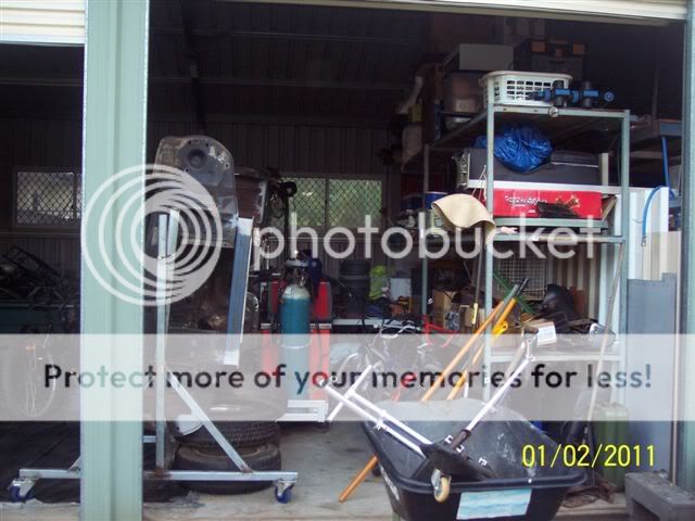 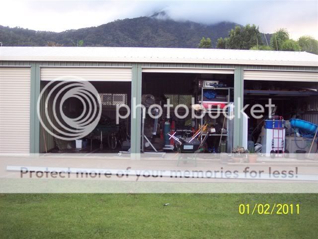 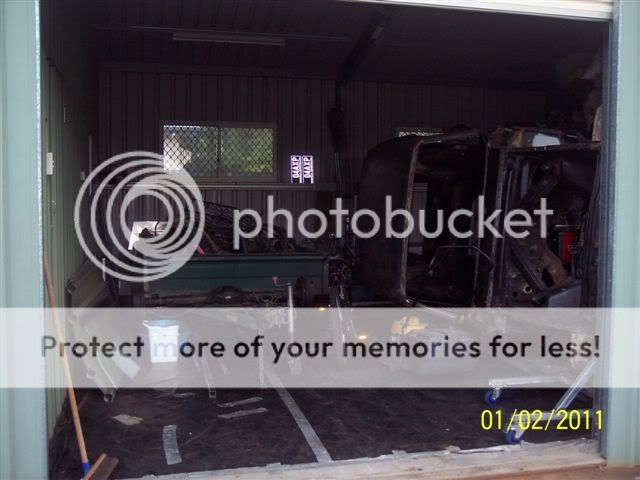 Expecting 150km/hr winds from about 4am in the morning - and the cyclone is not going to hit until 10pm tommorrow night. Expecting power outage for at least a week now. Mattress's are to go into the bathroom and onto the table. Had to pull Tin off the Caravan shed so it hopefully won't end up in the neighbours pool. 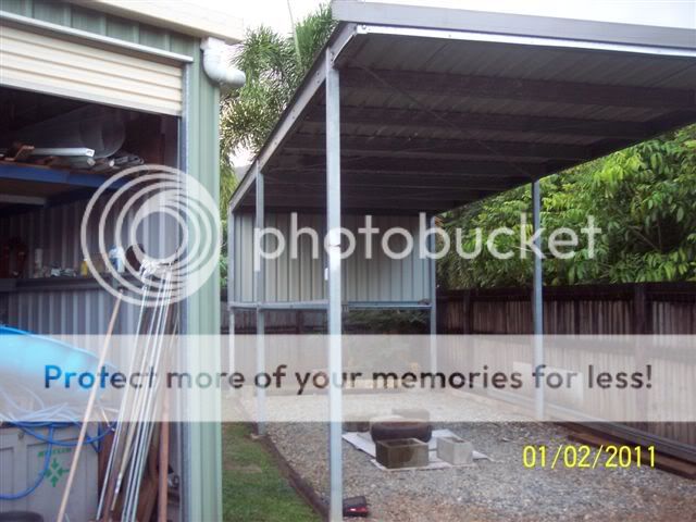
__________________
__________________________________________________ _________________________________ "Ford Vs Holden Day" 2013, Cairns, QLD Visit www.nqfordvsholden.com for details.  "It's only a Pinhole!" XP resto(SOLD) Last edited by Low006; 01-02-2011 at 09:35 PM. |
||
|
|
|
|
01-02-2011, 09:48 PM
|
#41 | |||
|
FF.Com.Au Hardcore
Join Date: Feb 2010
Location: Sun City, North Australis
Posts: 4,274
|
Quote:
Have to play the waiting game i guess. Just watching the radar at willis is and there is a large band of rain there but still not in range???
__________________
You've seen it, you've heard it and your still asking questions?? Don't write off the Goose until you see the box going into the hole.... |
|||
|
|
|
|
01-02-2011, 10:10 PM
|
#42 | ||
|
Ford Fanatic

Join Date: Feb 2005
Location: Brisbane
Posts: 1,480
|
Seriously I hope everyone in North Qld is going to be OK. I am in Brisbane and once again offer services for small dog or cat fostering if anyone needs it after the aftermath.
On the lighter side I saw this today: [IMG]  [/IMG] [/IMG]
__________________
Everyone is entitled to my Opinion  2007 Territory TX SY RWD Ego |
||
|
|
|
|
01-02-2011, 10:14 PM
|
#43 | ||
|
*** SPRINTY ***

Join Date: Sep 2009
Posts: 306
|
Another tonsvillian here, family starting to get a bit nervous, were on the northern beaches, have businesses in Townsville and cairns, especially concerned for my business and staff in cairns, seriously powerful storm cell, stay safe guys...
__________________
FORD FG-X XR8 SPRINT build no.495 |
||
|
|
|
|
01-02-2011, 11:53 PM
|
#44 | ||
|
Member 178

Join Date: Dec 2004
Location: Rockhampton
Posts: 1,385
|
Biggest cyclone I have ever seen. Glad I don't live up north anymore. I am seriously concerned for all up there.
|
||
|
|
|
|
02-02-2011, 12:16 AM
|
#45 | ||
|
I miss my wheelbarrow

Join Date: Jan 2005
Location: Bluestreak Performance
Posts: 11,500
 
|
Another adversary that the locals are up against is the clock.... this thing looks set to cross the coast just prior to midnight..... what a terrible time of day to have roofs being ripped off and the added uncertainty that the darkness brings.
I'm feeling for you guys. Daniel |
||
|
|
|
|
02-02-2011, 12:39 AM
|
#46 | ||
|
.

Join Date: Dec 2004
Location: Bundoora
Posts: 7,199
|
Been following this for a while now, with family up in Mackay. This has the potential to be the biggest seen in Australia, especially if it crosses land at Cat 5, towns a few 100km away will still see Cat 2 winds and rain. Course seems to indicate between Cairns and Innisfail, but most QLD cyclones track south a bit before landfall, so Townsville could also be in the firing line. The 100km wide eye would also mean several towns might see the worst. After landfall potentially the system will impact most of Australia's weather for the next week or so.
Batten up guys, get out if you are worried, there's been too many "perfect storms" the last few years whether it be fire, floods or storms. The worst part is, the weather guru's are saying that with the Pacific being so laden with moisture on top of warm waters, there is a possible 2 more cyclones to form and head to Australia in the next 2 weeks. |
||
|
|
|
|
02-02-2011, 12:42 AM
|
#47 | |||
|
Regular Member
Join Date: Jan 2010
Location: Top End
Posts: 456
|
Quote:
|
|||
|
|
|
|
02-02-2011, 12:46 AM
|
#48 | ||
|
.
Join Date: Dec 2004
Location: Bundoora
Posts: 7,199
|
Interesting comparison here, Yasi has potential to be one of the most powerful ever. I think Cyclone Tracey was a little larger than what the lower text reades but was still only a small cyclone compared to this

|
||
|
|
|
|
02-02-2011, 12:49 AM
|
#49 | ||
|
FF.Com.Au Hardcore

Join Date: Feb 2005
Location: Melb north
Posts: 12,025
|
you poor buggers are copping it, best of luck.
|
||
|
|
|
|
02-02-2011, 01:00 AM
|
#50 | ||
|
Ich bin ein auslander

Join Date: May 2005
Location: Loving the Endorphine Machine
Posts: 7,453
|
What can I say QLD, what have we done to deserve all this?
All those in the affected areas, be smart and be prepared, good luck. I will be ringing work tomorrow to register my name to travel up in the aftermath and help out.
__________________
Growing old is compulsory, growing up is optional! |
||
|
|
|
|
02-02-2011, 01:36 AM
|
#51 | |||
|
FF.Com.Au Hardcore
Join Date: Sep 2005
Location: Brisbane
Posts: 3,568
|
Quote:
http://www.bom.gov.au/products/natio...sat.loop.shtml looks dreadful rather like the beginings of TGracy so best wishes folks and get out of the coastal area NOW |
|||
|
|
|
|
02-02-2011, 03:20 AM
|
#52 | ||
|
Formerly "BOOFHEAD"
Join Date: May 2010
Location: Cairns, QLD
Posts: 221
|
Sick of waking every hour on the hour so up and it is as still as still can be. Text message and Telephone message from disaster managment saying mandatory evacuations now for low lying areas along coast. This was at 10.00pm - all good we are way above sea level - but feel for the people who are not. Everyone scared as we are just fresh from watching the floods and flash floods of Toowoomba and Brisbane. It is very real.
__________________
__________________________________________________ _________________________________ "Ford Vs Holden Day" 2013, Cairns, QLD Visit www.nqfordvsholden.com for details. "It's only a Pinhole!" XP resto(SOLD) |
||
|
|
|
|
02-02-2011, 03:39 AM
|
#53 | |||
|
Getting it done.....

Join Date: Oct 2006
Location: Brisbane
Posts: 2,219
|
Quote:
__________________
Dynamic White 1995 EF XR6 Auto Now with: Pacemaker 4499s Lukey Catback Exhaust Chrome BA XR-style tip Airdam Mounted CAI with modified (bellmouth) airbox Trip Computer install KYB shocks Bridgestone Adrenalin tyres Coming Soon: Exhaust Overhaul..... |
|||
|
|
|
|
02-02-2011, 07:09 AM
|
#54 | ||
|
*** SPRINTY ***
Join Date: Sep 2009
Posts: 306
|
Frm BOM, is now an official category 5, and moving south slowly, the eyenhas moved from cairns to innisfail, the only positive to this is its moving away from the larger centers of cairns but my goodness poor innisfail...
__________________
FORD FG-X XR8 SPRINT build no.495 |
||
|
|
|
|
02-02-2011, 07:18 AM
|
#55 | |||
|
I am Groot

Join Date: Dec 2007
Location: Burnett Heads, Qld
Posts: 6,840
|
Category 5 now guys, I hope everybody up there have made arrangements already and are not leaving it to the last minute, this is not one of those old "Cyclone Party" type situations....
Stay safe.... http://www.bom.gov.au/cgi-bin/wrap_fwo.pl?IDQP0005.txt Quote:
__________________
..  McLaren F1 Dick Johnson Racing McLaren F1 Dick Johnson Racing "Those were the days when the cars were cars, they weren't built out of an Ikea pack like they are now and clothed in plastic; they were real cars." John Bowe |
|||
|
|
|
|
02-02-2011, 07:30 AM
|
#56 | ||
|
Formerly "BOOFHEAD"
Join Date: May 2010
Location: Cairns, QLD
Posts: 221
|
Still very calm and yes "Swordsmans88" I know all about the winds. I have watched everything being destroyed in a couple of big ones, Cyclone Winifrid in 1986 I watched it destroy my families livelyhood, Cyclone Larry did it again and now this one. One reason I can't sleep - it's the waiting, wondering just how long the wind will go on, what part of the roof will come off, which part of the house will be blown away.
__________________
__________________________________________________ _________________________________ "Ford Vs Holden Day" 2013, Cairns, QLD Visit www.nqfordvsholden.com for details. "It's only a Pinhole!" XP resto(SOLD) |
||
|
|
|
|
02-02-2011, 07:59 AM
|
#57 | |||
|
Banned

Join Date: Jul 2007
Location: new south wales
Posts: 1,153
|
Quote:
looking at this radar image you would think the whole of queensland would be wiped out ,by the image it seems to stretch from brisbane to the tip of queensland but if you have a look at the live radar below it looks like a couple of clouds swirling of the coast . http://www.weatherzone.com.au/radar....wzstate&lc=qld |
|||
|
|
|
|
02-02-2011, 08:14 AM
|
#58 | ||
|
Lyminge, Shepway, Kent

Join Date: Oct 2008
Location: Geelong - Go Cats
Posts: 3,197
|
Good luck to all you northerners, I hope this is the last extreme weather event for a while.
|
||
|
|
|
|
02-02-2011, 08:18 AM
|
#59 | |||
|
I am Groot
Join Date: Dec 2007
Location: Burnett Heads, Qld
Posts: 6,840
|
Quote:
Another Satellite "loop" to give an idea of the size... http://www.bom.gov.au/products/IDE00902.loop.shtml Edit: The satellite will always give a better overall view than a radar due to the degredation of the radars signal in bad weather...
__________________
.. McLaren F1 Dick Johnson Racing "Those were the days when the cars were cars, they weren't built out of an Ikea pack like they are now and clothed in plastic; they were real cars." John Bowe Last edited by DJR-351; 02-02-2011 at 08:28 AM. |
|||
|
|
|
|
02-02-2011, 09:26 AM
|
#60 | |||
|
FF.Com.Au Hardcore

Join Date: Mar 2007
Location: sydney.nsw.au
Posts: 6,119
|
Quote:
__________________
flickr |
|||
|
|
|


 Linear Mode
